Hurricane Isaias strengthens in the United States, set to make landfall after record-late formation
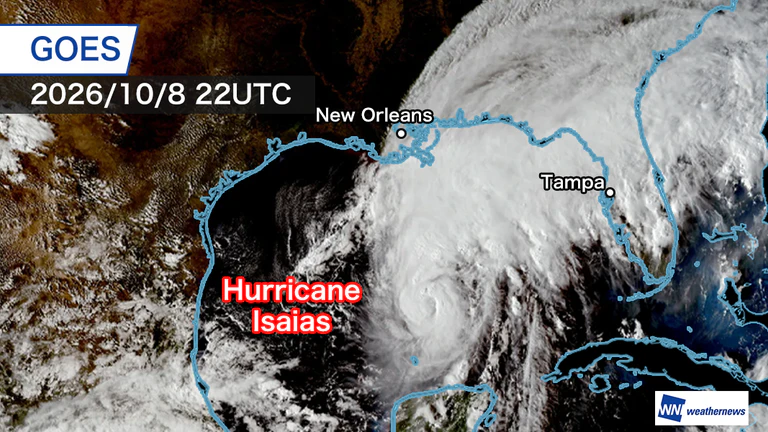
Latest-ever formation in the Atlantic and Gulf of Mexico
According to the National Hurricane Center, Tropical Storm Isaias strengthened into a hurricane on Thursday, the 8th.
As the season’s first hurricane, it set a record for the latest formation in the satellite era, which began in 1966, surpassing the previous record of September 11, set by storms including Humberto in 2013.
This year, tropical cyclone formation in the Atlantic and Gulf of Mexico had been significantly suppressed, partly because of a strong El Niño. But Isaias quickly became organized over the Gulf’s warm waters.
As of Thursday night, the 8th, Isaias was in the central Gulf of Mexico, moving northeast at about 20 km/h. Its central pressure was 974 hPa, and maximum sustained winds near the center had reached 45 m/s. The storm is approaching the mainland United States while strengthening.
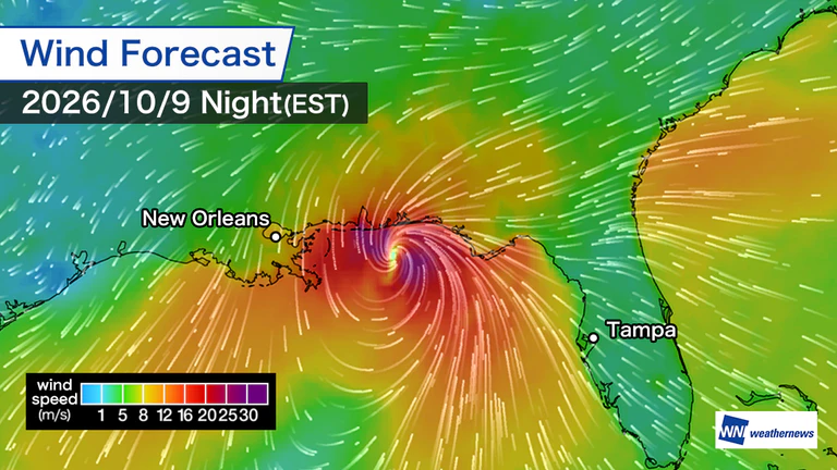
High alert for storm surge, heavy rain and strong winds
Isaias is expected to continue north while maintaining its strength. It is increasingly likely to make landfall along the coast from Alabama to northwestern Florida, in the southern United States, between Friday night, the 9th, and early Saturday, the 10th, local time.
As the storm approaches and makes landfall, life-threatening storm surge and strong winds are forecast along the Gulf Coast. Total rainfall is expected to reach 100–200 mm across a wide area. Heavy rain could cause flooding, and localized tornadoes are also a concern.
Weather authorities have issued hurricane and storm surge warnings across a broad stretch of the Gulf Coast. They are urging people to complete evacuations while it is still safe to do so before landfall and to take precautions against strong winds.

- Thu, 22/10Max 23° Min 16°

- Fri, 23/10Max 20° Min 14°

- Sat, 24/10Max 18° Min 16°

- Sun, 25/10Max 23° Min 16°

- Mon, 26/10Max 20° Min 17°
- Tue, 27/10Max 20° Min 14°

- Wed, 28/10Max 18° Min 13°

Latest News