Tropical Depression Develops in Bay of Bengal; Cyclone Expected to Make Landfall in India
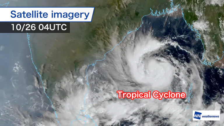
The tropical depression in the Bay of Bengal is gradually strengthening, aided by high sea-surface temperatures, favorable wind conditions for development and a supply of water vapor.
Analysis by the Global Storm Center at Weathernews, which monitors tropical cyclones worldwide, showed that the system had become a tropical cyclone by 00:00 UTC on Monday the 26th. Its central pressure was 998 hPa, and maximum wind speeds near the center had reached 18 m/s.
Satellite imagery also shows a well-defined cloud circulation, with active cumulonimbus clouds gathering near the center.
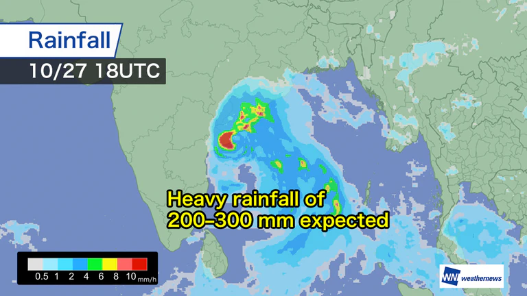
Heavy Rain of 200–300 mm Expected in Eastern India
The system is forecast to strengthen further, with maximum wind speeds near the center expected to reach 35 m/s in 36 hours.
It is expected to make landfall in eastern India near the peak of its development, bringing stronger winds and rain to the surrounding areas. Computer simulations indicate that total rainfall could reach 200–300 mm in some places, with damaging winds and high waves also possible, particularly along the coast.
India's meteorological authorities have issued a red alert, indicating the highest level of danger, mainly for areas in the cyclone's path, and are urging people to remain alert well ahead of its arrival.

- Tue, 27/10Max 24° Min 16°

- Wed, 28/10Max 19° Min 12°

- Thu, 29/10Max 16° Min 11°

- Fri, 30/10Max 19° Min 13°

- Sat, 31/10Max 24° Min 14°
- Sun, 01/11Max 18° Min 12°

- Mon, 02/11Max 22° Min 14°
Latest News