Tropical depression developing in the Bay of Bengal, expected to make landfall in eastern India
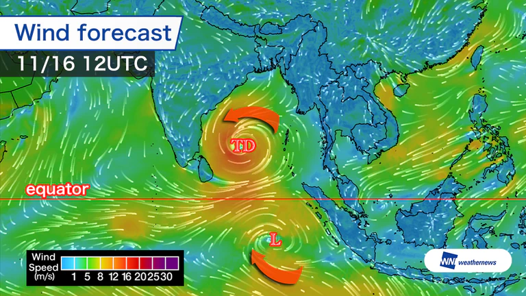
Low-pressure systems north and south of the equator, with winds rotating in opposite directions
An analysis for Sunday night, the 15th, local time shows a tropical depression in the central Bay of Bengal. It is expected to remain nearly stationary through Monday, the 16th, then move north while strengthening.
Another low-pressure system lies south of the equator. It is not currently being analyzed as a tropical disturbance and is still at the stage of being monitored for possible development.
Because low-pressure systems in the Southern Hemisphere rotate in the opposite direction from those in the Northern Hemisphere, the two systems aligned north and south of the equator have winds rotating in opposite directions.
Heavy rain and strong winds possible in eastern India
According to Weathernews' Global Storm Center, which monitors tropical cyclones worldwide, the system is expected to turn northwest from Wednesday, the 18th, and continue to strengthen.
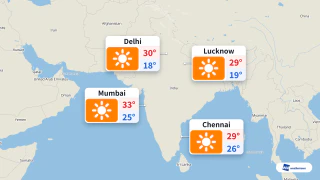
At its peak, it is forecast to reach maximum sustained winds of 25 m/s and gusts of about 35 m/s, and is expected to make landfall in eastern India from Thursday night, the 19th, through Friday, the 20th, local time. Forecast uncertainty remains high, and the landfall area could change.
Heavy rain is possible in areas as the system approaches and makes landfall, and caution is warranted.

- Tue, 17/11Max 14° Min 9°

- Wed, 18/11Max 19° Min 10°

- Thu, 19/11Max 19° Min 10°

- Fri, 20/11Max 15° Min 7°
- Sat, 21/11Max 16° Min 5°
- Sun, 22/11Max 14° Min 6°
- Mon, 23/11Max 14° Min 6°
Latest News