Cyclone Arnab makes landfall in eastern India; heavy rain prompts heightened vigilance in surrounding areas
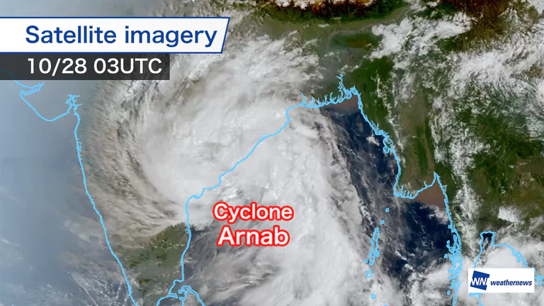
More than 200 mm of rain possible in 24 hours
Cyclone Arnab intensified rapidly over the central Bay of Bengal, reaching the India Meteorological Department’s Very Severe Cyclonic Storm category late on Monday, the 26th, local time.
Analysis by Weathernews’ Global Storm Center, which monitors tropical cyclones worldwide, estimated that maximum sustained winds near the center had reached 50 m/s by early Wednesday, the 28th, local time. The cyclone made landfall along the coast of Andhra Pradesh.
The landfall is forecast to bring locally more than 200 mm of rain in 24 hours to coastal areas, along with a storm surge 1–2 m above normal tide levels.
In the port city of Visakhapatnam, roads beneath railway overpasses were submerged, bringing transport networks to a standstill. In Amalapuram, Konaseema district, and elsewhere, strong winds brought down power poles and caused power outages. Damage has been reported along the coast.
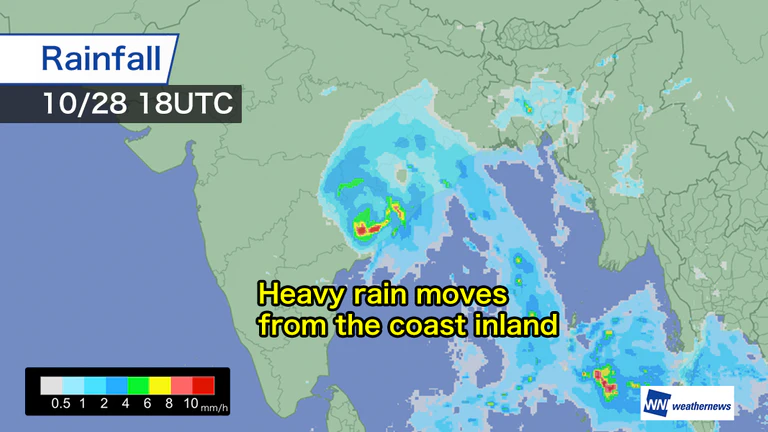
Active rain clouds to move inland into Odisha and Telangana
According to a Weathernews forecast, the cyclone is expected to weaken gradually as it moves inland after landfall. However, active rain clouds are expected to persist through Wednesday, the 28th, bringing continued heavy rain and strong winds.
As the cyclone tracks northwest, heavy rain is also possible in inland areas, including southern Odisha, Telangana and Chhattisgarh.
The India Meteorological Department has issued a red alert and urged people to remain vigilant for rising rivers, overflowing waterways and flooding, and to follow evacuation instructions from local authorities.

- Thu, 29/10Max 28° Min 19°

- Fri, 30/10Max 27° Min 19°

- Sat, 31/10Max 30° Min 18°
- Sun, 01/11Max 31° Min 18°
- Mon, 02/11Max 31° Min 17°
- Tue, 03/11Max 32° Min 17°
- Wed, 04/11Max 32° Min 17°
Latest News