Review of Typhoon No. 30’s forecast track: AI models outperform conventional models

Typhoon No. 30 (Champi) became an extratropical cyclone over the East China Sea, west of Kyushu, at 9 p.m. yesterday, Sunday the 25th.
A comparison of changes in weather-model forecasts (numerical simulations) with the storm’s actual track shows that AI models performed considerably better than conventional physics-based models for Typhoon No. 30, consistently forecasting a track close to the one it ultimately followed.
Track turns northeast across the East China Sea
As of 2026, the Japan Meteorological Agency, a Regional Specialized Meteorological Centre (RSMC), issues typhoon forecasts up to 5 days ahead. A review of the track-chart history shows that the storm generally stayed within the forecast circles from the outset, suggesting the forecasts were broadly on track.
However, forecasts beyond 5 days, for which no forecast circles are issued, differed considerably in accuracy depending on the type of weather model.
AI models forecast a track close to the actual path from early on
Each thin line in the charts accompanying this article represents the result of a numerical simulation calculated using a physical or AI model by a meteorological agency or other organization around the world. The lines connect the low-pressure center positions extracted from ensemble forecasts. Running many simulations with slightly different initial conditions provides a basis for assessing forecast confidence. Conventional physics-based weather models use computers to solve equations based on meteorological theory and predict future weather conditions. AI weather models, by contrast, learn how the atmosphere changes over time using data on past weather conditions, then use the trained model to forecast future conditions.
The comparison shows that, at first, many conventional physics-based models predicted that the storm would turn northeast from south of Japan and head toward areas east of the country. The trend changed sharply around the 16th, with more simulations showing the storm heading from near Taiwan toward the South China Sea. Forecasts of a northward track across the East China Sea became more common only after the 20th.
By contrast, simulations using AI technology showed little change in their forecast trend from the outset, and were more consistent. They continued to predict a northward track across the East China Sea from around the 14th, before the typhoon formed.
Ultimately, AI models were considerably more accurate than conventional physics-based models in forecasting Typhoon No. 30’s track.
The Weathernews Global Storm Center conducts quantitative evaluations of typhoon forecast models. It is also working to compile evaluations of storms other than No. 30.

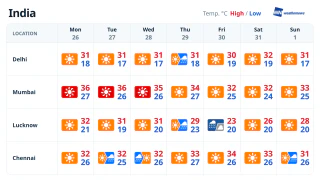
- Tue, 27/10Max 31° Min 17°
- Wed, 28/10Max 31° Min 18°
- Thu, 29/10Max 28° Min 19°

- Fri, 30/10Max 29° Min 20°
- Sat, 31/10Max 31° Min 18°
- Sun, 01/11Max 31° Min 17°
- Mon, 02/11Max 32° Min 17°
Latest News